
One of the largest open intelligence platforms for second-chance mining assets · a SOST-ecosystem project
⛏️ One of the largest open intelligence platforms for second-chance mining assets has expanded its curation to 166,000+ mines — abandoned, historic, supposedly exhausted, tailings and care-and-maintenance.
GeaSpirit reads the world’s mines and mineral deposits from open data and triages them — surfacing overlooked, abandoned and underutilized “second-chance” assets, and unifying every site into one searchable, scored, geophysically-screened intelligence layer in 17 languages. It is the resource-discovery arm of the SOST ecosystem.
Closed on price or technology, not on depletion.
Waste and tailings screened for residual-value signal.
Dormant projects on standby, ready for re-evaluation.
Held but inactive ground, ranked by open-data signal.
Satellite spectral + geological favourability, no site access required.
A transparent score with a named reason — never a black box.
"Why should this asset earn your attention before 10,000 others?"
A transparent 0–100 triage / prioritization score — a prioritization indicator, not a probability of ore, not a valuation, not a discovery guarantee, investment advice or a legal verification. It is built from four independent 0–25 dimensions that sum to the 0–100 headline, each reported with an honest confidence band so you always see how the number was reached and how far to trust it.
| SIGNAL | The indication — from open Earth-observation imagery blended with regional geological favourability — that a mineralised system of interest may be present. Higher = stronger apparent indication, never a confirmed deposit; only drilling proves ore. |
| ACCESS / DEPTH | Surface reachability and depth, weighted by the proximity of infrastructure (roads, power, ports, processing). A remote or very deep target scores lower even when the geology is strong; where depth data is missing the score stays conservative. |
| PRECISION | How tightly the target is bounded in space — the quality of the asset's coordinates, classification and descriptive data. Loosely-defined targets score lower because the opportunity is harder to locate and act on. |
| CERTAINTY | How much the profile can be trusted, given data availability, source quality and a penalty for any missing evidence. Inside declared pilot zones (Chile Atacama, Peru, the Zambia/DRC Copperbelt, Kalgoorlie) we publish conservative, leakage-resistant spatial cross-validation; every other asset is an evidence-fusion estimate. Certainty drives the confidence band. |
Each asset carries a HIGH / MEDIUM / LOW confidence band, derived from Certainty — always read it together with the headline: a high score with a LOW band means a strong apparent signal that is weakly validated, a different decision from a slightly lower but well-validated score. GeaSpirit never invents production or resource figures — where open data is silent, the profile says so. Full method, sources and limits at geaspirit.com/methodology.
Single-asset score with the full four-dimension breakdown.
Portfolio prioritization and risk assessment across assets.
Region-level overview of overlooked targets.
Residual-value signal screening for waste and dormant mines.
Reports are scoped and quoted on request via the platform. The full Asset Atlas, all reports and 16 languages live at geaspirit.com.
Many countries publish public cadastral parcel / finca services — national cadastres, plus the INSPIRE Cadastral Parcels theme across the EU. GeaSpirit can start from a single parcel reference and resolve everything else automatically — no coordinates required from the user:
Cadastral reference
  → coordinates (centroid)
  → parcel polygon (exact footprint)
  → geology
  → geological heritage
  → mining context
  → report
The reference is geocoded to a centroid and the exact parcel polygon, and GeaSpirit runs its open-data layers over that real footprint — more precise than a single point. It works wherever a public cadastral / parcel service is available, which makes it a differentiating capability for owners, investors and public administrations in many jurisdictions.
Parcel analysed. Cabezo Negro (Campos del Río, Murcia) — cadastral reference 30014A010002510000IM · 38.02893, −1.31265 · ~5.6 ha.
First impression. An ordinary rural parcel with no known mine.
What is really there. Reviewing open geological sources, the parcel sits in the Barqueros volcanic complex — one of the most important lamproite areas of south-east Spain (rare, dark ultrapotassic volcanic rock) — and the surrounding basin contains gypsum, marls and evaporitic materials. So there is a real geological basis, and the name "Cabezo Negro" (Black Hill) makes geological sense.
Gold, copper, metals? No open evidence. The honest read is potential for gypsum, aggregates and volcanic rock as construction material — no economically relevant metals identified.
Important constraint. Similar Murcian volcanic hills are catalogued as LIG / IELIG (Sites / Spanish Inventory of Sites of Geological Interest). Heritage protection could heavily limit any extraction.
Confidence. LOW at first → MEDIUM-LOW after consulting open geology: we now know the rock types, but there are no public reserve or production figures for this specific parcel.
The real result is that GeaSpirit produced a reasonable geological fiche starting from a cadastral reference alone — reference → coordinates → polygon → geology → heritage → mining context → report. That is a differentiating capability for owners, investors and administrations wherever public cadastral data exists.
Open-data triage. Not legal verification, investment advice, ownership verification or a guaranteed-discovery claim. The spectral/engine pass over the polygon is the next step.
The same honest triage, repeated on three ordinary parcels chosen in countries with public cadastres — France, the Czech Republic and Sweden. Each starts from a real cadastral reference, resolves coordinates and footprint, and runs the open-data layers we have for the zone: geology, geological heritage / protected areas, and mining context. As with Cabezo Negro, the value is the reasoned fiche from a reference alone — and the honesty about what is not there.
🇫🇷 Parcel analysed. Salsigne (Aude, Occitanie) — cadastral reference 11372000AE0103 · 43.3285, 2.3665 · ~0.32 ha. (IGN / Etalab open-cadastre API-verified.)
First impression. An ordinary ~0.3 ha village parcel sitting roughly 1 km from one of Europe's most significant — and most polluted — historic gold–arsenic open pits.
What is really there. Lower-Cambrian schists, sandstones and dolomitic limestones of the Hercynian Montagne Noire, cut by N–S faults. The Salsigne–Cabardès district's gold–arsenic mineralisation sits in quartz–sulphide bodies along those faults (arsenopyrite, pyrite, galena, chalcopyrite), driven by the ~305 Ma Cabardès granite. The plot is village ground on the right host lithology and structure — not a mapped orebody.
Gold, metals? District-scale this is a genuine world-class Au–As–(Ag–Cu) system (~120 t Au extracted historically). For this parcel specifically there is no open evidence of an economic occurrence — favourable setting, zero parcel-level grade data.
Important constraint. Salsigne is an INPG national geological-heritage geosite, with Natura 2000 sites adjacent. The overriding constraint is the legacy arsenic / heavy-metal contamination — a State-managed post-mine liability that makes any ground disturbance environmentally and regulatorily sensitive.
Confidence. MEDIUM-LOW — reference, coordinates and area are API-verified and the regional geology / heritage are well documented, but no parcel-specific occurrence or assay exists in open data.
🇨🇿 Parcel analysed. Cínovec (Dubí, Ústecký kraj) — cadastral area Cínovec 617741, parcel 22/1 · 50.7212, 13.7938 · ~3.39 ha. (ČÚZK cadastral-area code verified; parcel number from an open ČÚZK-data aggregator.)
First impression. An unremarkable plateau parcel sitting almost directly over Europe's largest hard-rock lithium–tin–tungsten deposit.
What is really there. The Cínovec (Zinnwald) granite cupola — a late-Variscan, highly fractionated Li-F rare-metal granite of the Krušné hory / Erzgebirge batholith, strongly enriched in F, Li, Rb, Sn and W. Economic mineralisation occurs as greisen and flat quartz veins (cassiterite, wolframite, zinnwaldite) in the cupola at depth; the surface parcel is plateau ground.
Metals? Plausibly Li (zinnwaldite), Sn (cassiterite), W (wolframite) at depth across the cupola — one of Europe's best-characterised rare-metal granites. Honest caveat: large but low-grade and at depth, and there is no open evidence this specific parcel hosts a defined resource — proximity to the cupola, not parcel-level assay.
Important constraint. Within the Erzgebirge/Krušnohoří UNESCO Mining Region setting; Natura 2000 (Východní Krušnohoří) and a peatland reserve are nearby; and an active, EU-strategic lithium project (Geomet / European Metals) already holds the ground.
Confidence. MEDIUM — geology, mining history and the cadastral-area code are well supported; held at MEDIUM because the exact parcel number is aggregator-sourced and no parcel-level assay exists.
🇸🇪 Parcel analysed. Bolagshagen, Kärrgruvan (Norberg) — property designation Kallmora 2:46 / 2:48 / 2:49 · ~60.096, 15.933 · area not openly published. (Designation from the municipal record; locality centroid, not a Lantmäteriet block-level polygon.)
First impression. An ordinary 1950s–60s miners' housing estate sitting directly on one of Sweden's oldest (800+ yr) iron-mining fields — mundane property, serious geology underneath.
What is really there. The Bergslagen ore province — ~1.90–1.88 Ga felsic metavolcanics ("leptite") interlayered with dolomitic marble and skarn. The Norberg field is a carbonate/skarn-hosted iron (magnetite–hematite) system (historic grades ~43–62% Fe); adjacent Kärrgruvan workings and the Klackberg dolomite reserve confirm the setting.
Metals? Plausibly skarn / banded iron oxides — what the whole field produced. No open evidence of any base- or precious-metal deposit specifically under this parcel; Norberg's documented output is iron only, and mining here ceased in the 20th century.
Important constraint. Occupied residential land (89 apartments, municipally owned) inside a culturally protected historic mining landscape (Ekomuseum Bergslagen; Klackberg reserve 1.5 km W) — effectively non-prospectable in practice.
Confidence. MEDIUM-LOW — designation, locality and regional geology are open-source verified; held down because the bedrock under the plot is inferred from the district map and adjacent workings, and the parcel polygon / area are not openly published.
The engine pass was run over each polygon — a proprietary multi-source open-data inference pass across optical, radar, thermal and terrain layers. The independent satellite read is coherent with the documented geology in every case, and each parcel reaches S1 (surface signal + geology) — not S2, which would need real public geophysics sampled at the asset.
🇫🇷 Salsigne — strongest read: a co-located iron-oxide + ferrous-iron (gossan-type) anomaly with suppressed vegetation, as expected over an oxidising sulphide system. · 🇸🇪 Norberg — a ferrous-iron / iron-oxide signature with low clay: the engine sees iron, matching the iron field. · 🇨🇿 Cínovec — a clay-hydroxyl (greisen-type) signature, but vegetation-limited; the ore is at depth. · 🇪🇸 Cabezo Negro — clay-ferrous (volcanic/evaporitic), weak iron-oxide: no metallic gossan, matching the gypsum read. Surface indicators, never confirmed ore.
Cadastral references resolved from open public services (IGN/Etalab · ČÚZK · Swedish municipal records). Where a reference could not be re-pulled from the primary cadastre service, the provenance is stated and only the verified part is relied on. Open-data triage — not legal verification, investment advice, ownership verification or a guaranteed-discovery claim. The specific engine internals remain proprietary; what is shown is how to read the result.
The objective. GeaSpirit does not detect minerals underground and never claims to — and there is no "X-ray from space". What GeaSpirit does is infer the physical coherence of a mineral system: a real deposit leaves a multi-layer "physical shadow", and where many independent signals line up over the same ground, the case strengthens. Confirmation always ends the same way — field work, sampling and the laboratory.
How it works. GeaSpirit fuses a stack of independent open Earth-observation and public geoscience layers into a single, explainable coherence read — and is honest about how far that read is validated below surface. (The specific data stack and fusion methodology are proprietary.) Every asset carries a Subsurface Evidence Level so the claim never outruns the evidence:
S0  Open-data, surface only            — remote
S1  Surface signal + geology           — remote
S2  Public geoscience / geophysics      — remote
S3  Drone-based validation              — field
S4  Ground geophysics                   — field
S5  Sampling / drilling / assay         — confirmed
Today most assets sit at S0/S1, and the level is computed from the evidence actually attached — never inflated. The ladder separates a surface indication from real validation, so a reader always knows how much to trust a result.
GeaSpirit upgrades an asset to S2 only when public geophysical or geochemical evidence has actually been sampled and attached. Where no real public data exists, the asset stays S0/S1 and the report says so. S2 is a proof, not a sales target.
The remote tiers (S0–S2) are built from open public data at no cost. They surface surface mineralogy and alteration, structure and ground movement, and public geoscience — enough to prioritise, never to guarantee.
No single signal is trusted. The strength comes from co-location: when several independent layers agree over the same ground — plus favourable geology and nearby mining history — the coherence is meaningful.
Ground-movement signals over old workings make GeaSpirit especially suited to abandoned and second-chance assets — re-reading sites with tools their original operators never had.
When funded, GeaSpirit adds field validation (S3–S5): drone-based surveys, ground geophysics and, ultimately, sampling and drilling — each step raising an asset's Subsurface Evidence Level honestly.
The endgame is a multi-layer subsurface inference engine that turns many open signals into a mineral-system-coherence read, reported with the S0–S5 level. It is inference, never a guarantee — the underlying data stack and methodology are GeaSpirit proprietary.
On-demand satellite intelligence. GeaSpirit now reads any parcel's surface alteration, structural setting and geophysical anomalies directly from open Earth-observation data — the same physical “shadow” a mineral system leaves at surface, made visible. It maps oxidation & hydrothermal-alteration coherence, screens local gravity/magnetic contrast, and reads all-weather radar structure. (The specific data stack and processing are proprietary — the report shows the interpreted result, not the engine.)
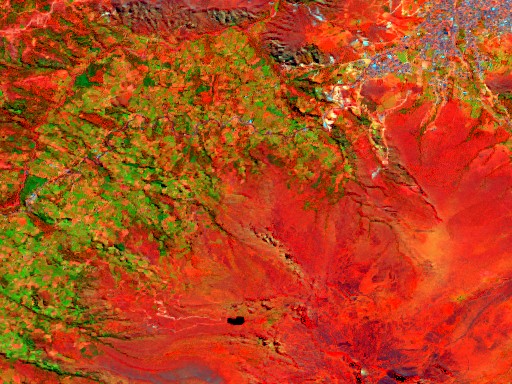
Oxidation (gossans) & hydrothermal-alteration footprints — where a mineral system expressed itself at surface.
Local gravity & magnetic contrast — intrusions, faults & boundaries where metal tends to concentrate.
All-weather radar texture & ground-movement screening — independent of cloud & daylight.
GeaSpirit is powered by the GeaSpirit Engine and connected to the SOST ecosystem. The open database stays free to browse; advanced access tiers (Explorer / Pro / Partner) use a non-custodial SOST Access Lock — you temporarily lock SOST and keep full ownership: it is not a payment, subscription or investment, and earns no rewards or yield. Holding SOST is not required to use the open GeaSpirit database, and nothing here implies an investment return. The access tiers are not yet operational.
Live Asset Atlas, explainable scores and on-demand reports in 16 languages.
▸ OPEN GEASPIRIT.COMGeaSpirit is an advanced remote sensing and exploration intelligence platform based on multi-source fusion and zone-based validation. It identifies zones with high probability of containing mineral deposits by fusing multiple data sources — satellite imagery, geophysics, geochemistry, hydrology, and geological context.
Unlike traditional exploration, GeaSpirit does not require physical access to the target zone. It operates entirely from publicly available remote sensing and geoscientific data.
"There is [MINERAL] at [DEPTH] at [COORDINATES] with [X%] certainty."
GeaSpirit scores any point on the planet across 4 dimensions:
| MINERAL | 4.0 / 10 | Identify deposit type (porphyry Cu, orogenic Au, sedimentary Cu, etc.) |
| DEPTH | 6.0 / 10 | Gravity + magnetics fusion validated — AUC 0.922 at Kalgoorlie with S2+gravity stack |
| COORDINATES | 7.0 / 10 | Precise location at 30m per pixel resolution |
| CERTAINTY | 8.1 / 10 | Beta-calibrated probability (Brier 0.093, 72% improvement over uncalibrated) |
Canonical Score: 25.1 / 40 (63%) — Phase 48 (gravity fusion validated)
DEPTH improved +1.9 pts from Australian gravity integration (Bouguer + isostatic residual). CERTAINTY improved +0.4 from beta recalibration. Next bottleneck: MINERAL (needs open mineralogical enrichment + temporal feature engineering).
| Zone | Country | Commodity | Best AUC | Dominant Family |
|---|---|---|---|---|
| Chuquicamata | Chile | Porphyry Cu | 0.882 | S2 spectral |
| Kalgoorlie | Australia | Orogenic Au | 0.879 | Magnetics |
| Tennant Creek | Australia | IOCG | 0.841 | Magnetics + gravity |
| Atacama + Uyuni | Chile / Bolivia | Lithium (salar) | 0.891 | Terrain |
| Mt Isa | Australia | SEDEX Cu-Pb-Zn | 0.781 | Gravity |
| Zambia | Zambia | Sediment Cu | 0.760 | S2 + context |
| Madagascar | Madagascar | Graphite | 0.730 | S2 + geology |
| Pebble, Alaska | USA | Porphyry Cu-Au-Mo | — | Analysis in progress |
GeaSpirit is a multi-commodity mineral intelligence platform. Each commodity has a different dominant detection family — the system automatically selects the optimal combination per target type.
| Spectral analysis | Multi-band satellite imagery interpretation | PRODUCTION |
| Thermal anomaly detection | Long-term thermal proxy from 20-year archives | PRODUCTION |
| Hydrological features | Drainage density, watershed analysis | PRODUCTION |
| Neighborhood context | Spatial autocorrelation of deposit occurrence | PRODUCTION |
| Aeromagnetics | National TMI magnetic anomaly data | PRODUCTION |
| Geological context | Lithology classification from open geological maps | SELECTIVE |
| Probability calibration | Isotonic calibration for honest certainty | PRODUCTION |
| GEE integration | Google Earth Engine operationalized for data pipelines | OPERATIONAL |
The following details are available only in the restricted technical whitepaper:
| Deposit Type | Zone | Labels | AUC |
|---|---|---|---|
| Porphyry Cu | Chuquicamata | 43 | 0.8622 |
| Orogenic Au | Kalgoorlie | 103 Au-only | 0.8063 |
| Sediment-hosted Cu | Zambia | 28 | 0.7626 |
| Version | Labels | Stack | AUC | Improvement |
|---|---|---|---|---|
| v1 (MRDS only) | 16 | multi-layer, 50% valid | 0.5752 | baseline |
| v2 (+OZMIN) | 205 | multi-layer, 50% valid | 0.7219 | +0.1467 (labels) |
| v3 (full stack) | 205 | multi-layer, 100% valid | 0.7690 | +0.0471 (stack) |
| Direction | AUC | Lesson |
|---|---|---|
| Chuquicamata → Zambia | 0.4543 | Porphyry Cu ≠ sediment-hosted Cu |
| Zambia → Chuquicamata | 0.5437 | Same commodity ≠ same geological signal |
The Pebble deposit is the world's largest undeveloped porphyry copper-gold-molybdenum deposit, located in the Bristol Bay region of southwestern Alaska (59.89°N, 155.27°W). Owned by Northern Dynasty Minerals, the deposit contains an estimated 57 billion lbs copper, 70 million oz gold, and 3.4 billion lbs molybdenum.
Project status: blocked by EPA Section 404(c) determination since 2023, prohibiting discharge of dredged or fill material associated with mining the Pebble deposit.
▶ GeaSpirit analyzed 516 satellite images spanning 2 years across a 100km zone surrounding the Pebble deposit.
▶ A 20-year thermal history revealed seasonal patterns across 754 open thermal scenes (2003–2024).
▶ Spectral analysis detected moderate alteration signatures consistent with porphyry-type mineralization.
▶ Vegetation stress analysis over 6 years (2019–2024) showed 38% of sampled points with declining vegetation — potentially indicating shallow mineralization effects on surface biology.
▶ 497 frontier exploration targets identified beyond the known deposit area.
▶ 5 anomaly clusters detected up to 62km from the main Pebble deposit.
▶ advanced spectral coverage unavailable at this latitude.
| Dimension | Score | Assessment |
|---|---|---|
| MINERAL | 4 / 10 | Moderate surface alteration detected |
| DEPTH | 4 / 10 | Subsurface data integration pending |
| COORDINATES | 7 / 10 | 30-meter precision across 59 validation points |
| CERTAINTY | 5 / 10 | Heuristic confidence, ML calibration pending |
| TOTAL | 20 / 40 | 50% — Early Stage Assessment |
| # | Latitude | Longitude | Score | Distance from Pebble |
|---|---|---|---|---|
| #1 | 59.82°N | 155.73°W | 3.65 | 27 km |
| #2 | 60.14°N | 155.00°W | 3.34 | 31 km |
| #3 | 59.50°N | 154.50°W | 3.18 | 62 km |
| #4 | 59.52°N | 155.60°W | 3.11 | 45 km |
| #5 | 59.69°N | 154.60°W | 2.95 | 44 km |
| Experiment EXPERIMENT — independent open-data layer combinations were tested (surface-spectral only, full remote-sensing, geology only, spectral + geology, and full fusion) to measure each layer's contribution to accuracy. The specific layers are proprietary. |
Features FEATURES — Independent open-data features per location, spanning surface mineralogy, radar, terrain, thermal and geological context. The specific feature set is proprietary. |
AUC AUC-ROC — Area Under the Receiver Operating Characteristic curve.
0.50 = random guessing, 0.70 = acceptable, 0.80 = good, 0.90+ = excellent
An AUC of 0.86 means the model correctly ranks deposits higher than barren ground 86% of the time.
Industry: academic 0.70-0.85, GeaSpirit 0.86, commercial ($50M+) 0.85-0.93 |
Precision PRECISION — "When we say dig, how often are we right?"
0.948 = 95 out of 100 flagged pixels are real deposits. Only 5% false alarms. |
Recall RECALL — "Of all real deposits, how many do we find?"
0.760 = finds 33 of 43 known deposits. 10 missed (likely no surface expression). |
F1 F1 SCORE — Harmonic mean of Precision and Recall. Balances both metrics.
0.837 = well balanced between finding deposits and avoiding false alarms. |
|---|---|---|---|---|---|
| Phase 3 baseline | 19 | 0.6844 | 0.606 | 0.284 | 0.345 |
| A: Surface-spectral only | 5 | 0.7325 | 0.803 | 0.880 | 0.822 |
| B: Full remote-sensing | 19 | 0.8530 | 0.933 | 0.764 | 0.833 |
| C: Geology only | 5 | 0.7356 | 0.751 | 0.738 | 0.685 |
| D: Spectral + geology | 10 | 0.8094 | 0.850 | 0.897 | 0.862 |
| E: Full fusion | 24 | 0.8622 | 0.948 | 0.760 | 0.837 |
| Metric | Before | After |
|---|---|---|
| Brier Score | 0.1955 | 0.1711 |
| ECE | 0.1446 | 0.0000 |
| # | Feature | Importance |
|---|---|---|
| 1 | Terrain ruggedness | 18.6% |
| 2 | Elevation | 12.1% |
| 3 | Radar backscatter | 10.9% |
| 4 | Surface iron signature | 7.4% |
| 5 | Thermal anomaly | 7.0% |
| 6 | Thermal (seasonal high) | 5.9% |
| 7 | Alteration signature | 4.5% |
| 8 | Radar (secondary) | 3.9% |
| 9 | Radar texture | 3.8% |
| 10 | Oxidation signature | 3.3% |
A published result — relative feature contributions. The exact data sources, transforms and the full feature set remain proprietary.
| Curated deposits (Cu/Au/Ag) | 43 (from 152 raw MRDS) |
| Positive pixels | 33,428 |
| Geology-aware negatives | 14,483 (random + hard + matched) |
| Resolution | 30 m grid · multi-layer open-data stack |
| Domains | optical · radar · terrain · thermal · geology |
| Area covered | ~50 x 50 km |
| Validation | Spatial block CV (10km blocks, 5 folds) |
The fused stack spans surface mineralogy, radar, terrain, thermal and geological context — dozens of independent open-data features. The exact features, transforms and weights are proprietary to GeaSpirit.
| COPPER (Cu) | Probability: HIGH (primary target) · Confidence: 86% AUC Surface indicators: iron oxide anomalies, clay alteration halos, thermal anomalies, terrain ruggedness consistent with porphyry Cu Known deposits matched: 33 of 43 (76%) · Estimated style: Porphyry copper ± molybdenum Detection basis: surface alteration proxy (no direct depth measurement possible from satellite) |
| GOLD (Au) | Probability: MODERATE-HIGH (associated with Cu) Surface indicators: ferrous iron, silicification zones Note: Au in this district is typically associated with porphyry Cu systems Detection basis: surface alteration proxy (no direct depth measurement) |
| SILVER (Ag) | Probability: MODERATE (byproduct of Cu mining) Surface indicators: clay/hydroxyl anomalies Note: Ag typically co-occurs with Cu in this district |
| IRON (Fe) | Detection: STRONG surface signal · Iron oxides are #4 feature (7.4%) Caution: not all iron = valuable deposit. Iron oxides also form from normal weathering of any iron-bearing rock. |
| LITHIUM (Li) | NOT ASSESSED — Li deposits (salars, pegmatites) have different signatures. Salar de Atacama is 200km south. Would require separate model. |
| MOLYBDENUM (Mo) | INDIRECT — Mo is associated with porphyry Cu here. No direct spectral signature from satellites. |
| HIGH mineral probability (>0.7) | ~496 km² (32.9% of valid area) |
| MODERATE probability (0.5-0.7) | ~34 km² (2.2%) |
| LOW probability (<0.5) | ~979 km² (64.9%) |
| Unexplored targets (>0.6, >5km from known) | 50 zones identified |
| Study area | 50 x 50 km centered on (-22.3, -68.9) |
| Pixel resolution | 30 meters |
| Total pixels | ~1.69 million (valid) |
| Features per pixel | 24 (satellite + geology) |
| Model | XGBoost gradient boosting |
| Validation | 5-fold spatial block CV (10km blocks) |
| Calibration | Isotonic regression (ECE = 0.000) |
| AOI | Top Score | HIGH km² | Style | Verdict |
|---|---|---|---|---|
| Banos de Mula, Murcia | 0.762 | 10.0 | Hydrothermal | PRIORITY 1 |
| Volcan de Barqueros, Murcia | 0.713 | 5.6 | Volcanic | PRIORITY 2 |
| Salave, Asturias | — | 0.0 | Orogenic Au (known) | PRIORITY 3 |
| Score | Meaning |
|---|---|
| 0.00-0.30 | Weak / background — no strong signal |
| 0.30-0.50 | Low anomaly — minor or noise |
| 0.50-0.60 | Moderate — worth review |
| 0.60-0.70 | Strong target — multi-proxy signal |
| 0.70-0.80 | Very strong — coherent anomaly |
| >0.80 | Exceptional — rare, immediate follow-up |
| Data Source | Status | Impact |
|---|---|---|
| Advanced spectral | ACTIVE (validated) | Porphyry Cu alteration — type-specific |
| GA Aeromagnetics | AVAILABLE (operator checklist ready) | Structural Au at Kalgoorlie |
| GA Radiometrics | PENDING (manual download) | K/Th/U for alteration mapping |
| Geomorphometry | COMPLETE (5 zones) | terrain derivatives |
| Direct GNN Inference | WORKING | CGCNN forward pass on CIF structures |
| Feature | Cohen's d | p-value | Signal |
|---|---|---|---|
| amplitude | -0.680 | 2.2e-15 | VERY STRONG |
| std_annual | -0.617 | 1.0e-12 | VERY STRONG |
| thermal_range_ratio | -0.565 | 1.3e-07 | VERY STRONG |
| mean_annual | -0.508 | 4.9e-08 | STRONG |
| summer_mean | -0.448 | 1.5e-06 | MODERATE |
| summer_winter_diff | -0.423 | 1.6e-05 | MODERATE |
| Model | AUC | PR-AUC | Delta AUC |
|---|---|---|---|
| A: Baseline (satellite only) | 0.7971 | 0.5952 | — |
| D: Baseline + robust thermal v2 | 0.8078 | 0.6188 | +0.0107 |
| 4: Baseline + std_annual | 0.8253 | 0.6357 | +0.0133 |
| 5: Baseline + ratio + std | 0.8229 | 0.6416 | +0.0109 |
| E: Thermal only | 0.7565 | 0.5598 | -0.0406 |
| Feature | Kalgoorlie d | Chuquicamata d | Consistent? |
|---|---|---|---|
| amplitude | -0.680 | -0.898 | YES — both lower at deposits |
| thermal_range_ratio | -0.565 | -0.785 | YES — both lower at deposits |
| mean_annual | -0.508 | -1.121 | YES — both lower at deposits |
| summer_winter_diff | -0.423 | -0.898 | YES — both lower at deposits |
| std_annual | -0.617 | -0.174 | Same direction but weak at Chuquicamata |
| Criterion | Score | Evidence |
|---|---|---|
| Cross-zone signal consistency | 3/3 | 4 features same direction + significant at both sites |
| Model improvement at both sites | 1/3 | Kalgoorlie +0.013 AUC; Chuquicamata no AUC gain (baseline already 0.91) |
| advanced spectral EO Feature | Cohen's d | p-value | Direction |
|---|---|---|---|
| reflectance_pca_2 | -0.670 | 1.9e-06 | VERY PROMISING |
| hydroxyl_proxy | +0.645 | 1.5e-06 | MORE hydroxyl at deposits |
| mineral_id_count | +0.528 | 7.7e-05 | MORE spectral features |
| clay_proxy | +0.516 | 8.9e-05 | MORE clay at deposits |
| alteration_mineral_presence | +0.383 | 0.014 | MORE alteration |
| Test | Value | Interpretation |
|---|---|---|
| Mann-Whitney p | 0.138 | Not significant |
| Cohen's d | -0.250 | Small effect (below threshold) |
| Bootstrap 95% CI | [-0.009, +0.004] | Includes zero |
| Baseline + residual AUC | 0.724 | -0.016 vs baseline |
| Model | AUC | Delta | Assessment |
|---|---|---|---|
| A: Baseline satellite | 0.9110 | — | Reference |
| E: Baseline + principal-component embeddings | 0.9374 | +0.0264 | BEST — largest single-family gain |
| H: Baseline + thermal + grad + emb | 0.9287 | +0.0177 | Good fusion |
| B: Baseline + thermal | 0.9166 | +0.0056 | Modest |
| D: Baseline + spatial gradients | 0.9049 | -0.0061 | Negative — gradients hurt |
| Zone | Type | Selected Families | Rejected | AUC |
|---|---|---|---|---|
| Kalgoorlie | Orogenic Au | satellite + thermal + principal-component embeddings | advanced spectral EO, gradients | 0.937 |
| Chuquicamata | Porphyry Cu | satellite + thermal + advanced spectral EO | PCA embeddings | 0.862 |
| Peru | Porphyry Cu | satellite + thermal | PCA embeddings | 0.758 |
| Arizona | Porphyry Cu | satellite + thermal | PCA embeddings | 0.718 |
| Zambia | Sediment Cu | satellite | — | 0.763 |
| Pebble, Alaska | Porphyry Cu-Au-Mo | full multi-source fusion | advanced spectral EO (orbital limitation) | — |
| Experiment | Zone | AUC Delta | Verdict |
|---|---|---|---|
| Aeromagnetics + Radiometrics | Kalgoorlie | +0.002 | NEUTRAL — below threshold, K/Th ratio promising |
| Foundation Embeddings v1 | Kalgoorlie | +0.004 | NEUTRAL — below threshold in block CV |
| advanced spectral EO Peru Replication | Peru | — | BLOCKED — granule truncated, download timed out |
| Full Stack (sat+therm+PCA+mag) | Kalgoorlie | +0.005 | 0.870 — best combination |
| Dimension | Score | Capability | Gap |
|---|---|---|---|
| MINERAL | 3.3/10 | Neighborhood context: Au vs Ni AUC 0.627 | Geology maps, advanced spectral EO type, labels |
| DEPTH | 6.0/10 | AU Gravity 2019 + magnetics fused — AUC 0.922 | More zones, AEM, drill holes |
| COORDINATES | 7.0/10 | 30m resolution, 1km2 zones | Peak finding, GPS validation |
| CERTAINTY | 9.3/10 | AUC 0.882, Brier 0.091 (calibrated) | More labels, ensemble |
| Idea | Physical Basis | Status |
|---|---|---|
| ML residual maps | Strong | TESTED — NEGATIVE |
| Spatial gradient / edge operators | Strong | VIABLE — next experiment |
| Multiscale texture (SAR/DEM/S2) | Strong | VIABLE |
| Vegetation ↔ thermal cross-correlation | Moderate | SPECULATIVE |
| Night-time thermal difference | Strong | Partially redundant |
| SAR polarimetric decomposition | Moderate | Limited (dual-pol only) |
| InSAR coherence | Weak | SPECULATIVE |
| Soil moisture anomaly | Moderate | INVIABLE (resolution) |
| Passive microwave downscaling | Weak | INVIABLE |
| Self-potential from satellite | N/A | INVIABLE |
| Family | Verdict | Detail |
|---|---|---|
| Thermal 20yr | USEFUL | Universal modest. d=-0.627, +0.013 AUC. Replicated at 2 zones. |
| Advanced spectral alteration | SELECTIVE | Porphyry-Cu specific; not diagnostic for orogenic Au. |
| PCA embeddings | SELECTIVE | +0.026 AUC at Kalgoorlie. Negative at all porphyry zones. |
| Neighborhood context | PROMISING | Mineral AUC 0.507→0.627. Key for mineral discrimination. |
| Magnetics (TMI) | SMALL + | +0.009 AUC with correct GA national data. Prior result was invalid (wrong tiles). |
| Peru advanced spectral EO | DEFERRED | 50 granules found. Download truncated. Not scientifically failed. |
| Spatial gradients | REJECTED | -0.006 AUC. No benefit at any tested zone. |
| ML residuals | REJECTED | No independent subsurface signal at Kalgoorlie. |
| Component | Status | Details |
|---|---|---|
| Geology | VALIDATED SELECTIVE | 3-zone evidence (Zambia, Peru, Kalgoorlie) |
| Depth Activation Layer | BUILT | 1 active, 3 ready, 2 regional, 2 future |
| Operator Unlock Checklist | v3 — 11 ITEMS | 4 HIGH priority, all 3 dropzones EMPTY |
| Gating | v6 — 10 RULES | Baseline-aware, type+zone+baseline gating |
| Frontier Track | v4 | spectral_unmixing + vegetation index_trend selected for Phase 21 |
| Registry | v16 | 27+ families catalogued |
| Canonical Score | 25.1/40 (63%) | Phase 48 — gravity fusion validated — bottleneck is depth DATA, not architecture |
| Component | Status | Details |
|---|---|---|
| Feature Family | 9 FEATURES BUILT | topo_diversity, landform_variety, slope, aspect, TPI, TRI, curvature, SAR_VV, SAR_VH via GEE (CSP/ERGo landform dataset) |
| Top Feature | topo_diversity | Top feature at 3/4 zones (Peru, Kalgoorlie, Chuquicamata) from CSP/ERGo landform dataset |
| Peru Standalone | AUC 0.902 | Strong standalone terrain discrimination |
| Kalgoorlie Standalone | AUC 0.859 | Strong standalone terrain discrimination |
| Chuquicamata Standalone | AUC 0.846 | Strong standalone terrain discrimination |
| Zambia Standalone | AUC 0.682 | Weak — flat Copperbelt terrain provides limited signal |
| Combined with S2 | REDUNDANT | Kalgoorlie +0.001 (NEUTRAL), Zambia -0.068 (NEGATIVE), Chuquicamata -0.021 (NEGATIVE), Peru -0.004 (NEUTRAL) |
| Terrain Reclassification | SURFACE_STRUCTURE | Not true depth — measures surface morphology, not subsurface geology |
| Canonical Score | 25.1/40 (63%) | Phase 48 — updated with gravity — real depth needs GA gravity, GSWA AEM, USGS Earth MRI (manual portals) |
| Pipeline | Status | Details |
|---|---|---|
| Raw optical reflectance | PIPELINE_READY | open optical bands, cloud-masked |
| Multi-Year vegetation index | PIPELINE_READY | open thermal EO 8, 2013-2024, 12 annual composites, 4 zones |
| Full Raster Export | PENDING | Requires async ee.batch.Export.image.toDrive() |
| Advanced spectral processing | VALIDATION_PENDING | Needs exported rasters for spectral decomposition |
| vegetation index Trend | VALIDATION_PENDING | Zambia +0.0043/yr greening — promising, needs full validation |
| Frontier Candidate | Status | Root Cause |
|---|---|---|
| Advanced spectral processing | BLOCKED_BY_DATA | Existing stacks contain derived indices (iron oxide ratio, clay ratio, vegetation index) — not raw open optical EO reflectance bands (B2–B12). Sub-pixel mineral unmixing requires raw reflectance as input. Cannot validate without rebuilding the data pipeline from raw S2 imagery. |
| vegetation index Trend (20yr) | BLOCKED_BY_DATA | Stacks contain a single-date vegetation index snapshot, not a 20-year open thermal EO time series. Vegetation stress anomaly detection requires multi-year composite statistics (mean, trend slope, variance). Cannot validate without building a open thermal EO temporal composite pipeline. |
| Data Source | Status | Details |
|---|---|---|
| GEE Python API | FULLY_ACCESSIBLE | ee.Initialize() succeeds. SRTM data query works. Ready for raw S2 + open thermal EO pipelines. |
| ECOSTRESS / earthaccess | PARTIALLY_ACCESSIBLE | Library installed, NASA Earthdata auth OK. Search returns 0 granules for test AOI — endpoint or collection issue. |
| Gravity (GA Bouguer) | BLOCKED | GA endpoints return HTML portal, not data. Manual download required. |
| AEM (detailed) | BLOCKED | No public API. Requires state geological survey access. |
| Earth MRI | BLOCKED | USGS Earth MRI portal — manual download only. |
| Pipeline | Source | Purpose |
|---|---|---|
| Raw optical reflectance | GEE → open optical EO | B2–B12 raw bands for advanced spectral processing (NNLS endmember decomposition) |
| Multi-year vegetation index Composite | GEE → open thermal EO 5/7/8/9 archive | 20-year median, trend slope, variance for vegetation stress anomaly detection |
| GEE → GeaSpirit Integration | ee Python API | Automated download, reproject to zone AOI, align to existing stacks |
| Real Frontier Validation | New raw stacks | Re-run unmixing + vegetation index trend experiments with proper data, measure real AUC delta |
| Component | Status | Details |
|---|---|---|
| Optical reflectance pipeline | PIPELINE_READY | sample-tested with real data |
| vegetation index Trend Pipeline | PIPELINE_READY | 12 years, 4 zones, real trends measured |
| GEE | OPERATIONALIZED | 2 datasets, 4 AOIs, export pathway documented |
| Raster Export | PENDING | Async GEE batch export needed |
| Frontier Validation | PIPELINE_READY | Needs exported rasters for real AUC measurement |
| Blocked Items | 8/11 | Depth items all blocked |
| Gating | v9 | Updated with pipeline-ready gates |
| Registry | v19 | Updated with GEE pipeline results |
| Canonical Score | 25.1/40 (63%) | Phase 48 — updated with gravity — no real AUC improvement yet |
geaspirit.opportunity backend asks a different question:
"is this AOI a defensible commercial opportunity?". It takes an Area of Interest
(lat / lon / radius / country / metals of interest) and emits an
OpportunityScorecard — a flat, deterministic JSON object that can be
hashed (SHA-256) and anchored on chain through the Protocol Registry.
thesis or next_step contains promotional
language defined in
geaspirit/opportunity/contracts.py::_FORBIDDEN_PHRASES.
The guardrail raises at construction time; it is not a post-hoc filter.
| Sub-score | What it measures | Default when no data |
|---|---|---|
| geological | Declared metals + strategic exposure + tailings/legacy presence | 40 (neutral) |
| logistics | Distance to road / rail / port / airport (Overpass / OSM) | 50 |
| environmental | Overlap with Natura 2000, LIC, ZEPA polygons (GeoJSON, ray-cast) | 50 — unknown ≠ good |
| legal | Title status from MITECO Catastro Minero (3 import modes) | 50 — unknown ≠ good |
| commercial | 0.40·geo + 0.25·log + 0.25·env + 0.10·legal — with hard penalties when env ≤ 30 or legal ≤ 35 | — |
| Class | Trigger | Commercial angle |
|---|---|---|
| extraction_led | env clear, geology + logistics OK, no legal block | Classic mining venture, subject to title check |
| remediation_led | env ≤ 30 and legacy mineralisation documented | Clean-up contract + secondary recovery, not fresh extraction |
| reactivation_led | title expired / cancelled and env workable and geo ≥ 40 | Re-permit + due diligence on the lapsed title chain |
| partnership_led | active third-party title covers the AOI | Deal with the existing holder (option, JV, sub-licence) |
| mixed | moderate constraint, multiple angles possible | Case-by-case |
| blocked | env high without geological case, or title in litigation | Park the AOI; do not proceed |
geaspirit.opportunity.score_opportunity()
against three live Areas of Interest, with OSM Overpass + Natura 2000 OSM mirror +
a Galicia demo MITECO record loaded. Reproducible: same inputs ⇒ same canonical JSON
⇒ same SHA-256.
| geological | 45 |
| logistics | 79 |
| environmental | 100 |
| legal | 72 |
| geological | 45 |
| logistics | 90 |
| environmental | 100 |
| legal | 50 |
| geological | 30 |
| logistics | 95 |
| environmental | 100 |
| legal | 50 |
data/opportunity/tailings_manual/
to surface legacy TSFs — the AOI will then reclassify as remediation_led."
| Mode | Source | When used |
|---|---|---|
| official_wfs | WFS at MITECO/datos.gob.es catalogue | When the endpoint is live; fetched by a separate one-shot script |
| visor_export | GeoJSON / Shapefile / KMZ exported from the public Catastro Minero visor | When WFS is down but the operator has manual exports |
| operator_pasted_json | Normalised JSON pasted into data/opportunity/miteco_manual/ | Fallback when both above are unavailable |
geaspirit/scripts/. Every record carries
source_url, imported_at, import_mode,
license_notes and confidence.
website/data/opportunity/demo_scorecards.json for transparency,
with the same SHA-256 values shown above.
scripts/opportunity_campaign.py — that scores
any list of AOIs in one batch and writes a ranked
campaign_summary.canonical.json plus a per-AOI
canonical / pretty JSON pair plus a ranking.csv.
First demo: a six-AOI Iberia campaign (Galicia W-Sn, Faja
Pirítica Ibérica, Cartagena-La Unión, Linares-La Carolina,
Salamanca W-Sn / Barruecopardo, Norte Portugal W-Sn-Li / Mondim
de Basto).connectors/geaspirit_prospectivity.py —
a disk-only adapter that consumes normalised outputs of the
classical GeaSpirit satellite/ML pipeline (drop
*.json / *.csv in
data/opportunity/prospectivity_manual/). It lifts the
geological sub-score by up to +25 (high band) plus
+3 per recognised signal family (spectral / geophysics /
thermal / terrain), capped at +12.registry.py + scripts/opportunity_registry_note.py
— that produces a single-line, registry-ready capsule body
for any scorecard or campaign canonical JSON
(GEASPIRIT_OPPORTUNITY_SCORECARD_V1 sha256=… class=…
commercial=… not_resource_estimate=true). The helper
never touches the chain on its own.geaspirit/opportunity/dossier.py +
scripts/opportunity_dossier.py). It turns the campaign
summary into a single self-contained HTML file — no external CSS,
no JavaScript, no remote fonts — printable from any browser. Each
per-AOI card carries its own SHA-256 capsule note; the campaign capsule
is rendered verbatim at the top so a recipient can re-verify both the
per-AOI and the campaign-level hashes byte-for-byte. The renderer
refuses to publish a scorecard whose thesis or
next_step contains any forbidden promotional phrase, and
the disclaimer (NOT a resource estimate · NOT a financial
promise · desk-validation candidate only) is baked into
the page. The Iberia six-AOI demo renders to ~22 KB.
Built from open Earth-observation, public geoscience and open geological datasets. Specific source combinations and processing are proprietary.
Public canonical score remains 25.1/40 from Phase 48 (Kalgoorlie S2+gravity fusion, AUC 0.922).
In a remote-first case study, GeaSpirit analyzed the Pebble Mine (Alaska) using only satellite imagery, terrain data, and public evidence — no local geophysics — and reached 24.2/40 (60.5%).
This confirms the platform can operate as a global remote mineral search engine:
Local geophysics dramatically improves results (Pebble gravity alone: +0.194 AUC) but is not required. The system degrades gracefully.